Sunday, October 28, 2018

The Oregon Coast

These photos come from the stretch of highway between Lincoln City and Newport, Oregon.


Yaquina Head Lighthouse.  This photo was taken at about 8:00 in the morning, on what would turn out to be a bright, sunny day.  However, all day long the fog just hung tight to the coastline.  I didn't even think I got this photo because literally seconds after I took it, the lighthouse was completely obscured by the fog.

Looking towards Yaquina Head Lighthouse (on the far right) from the village of Otter Rock, Oregon.


Gull Rock

Shore bird

Shore birds in the sunset


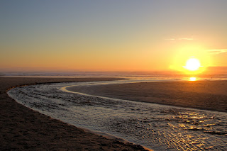
The D River flowing out of Devil's Lake into the Pacific Ocean

The D River flowing out of Devil's Lake into the Pacific Ocean.  It was a very, very cold river!

I could not find a name for this rock formation, but it sits in the Siletz River, just south of Lincoln City, Oregon

The sun sinking into the fog bank


Multnomah Falls, Oregon

A trip to the west coast took me through Portland, Oregon and Multnomah Falls is only about 30 minutes east of the airport.  It is the tallest waterfall in Oregon, with a height (of both falls combined) of 620 feet. 

A view of the upper and lower falls

A view of the upper and lower falls
The base of the upper falls

The upper falls

The lower falls


  © Blogger template 'Totally Lost' by Ourblogtemplates.com 2008

Back to TOP